P.O. Box 280041
Brooklyn, NY 11228-0041
Tel: 718-836-0674
1729 Map of Italy L'Italie Divisee en ses Estats
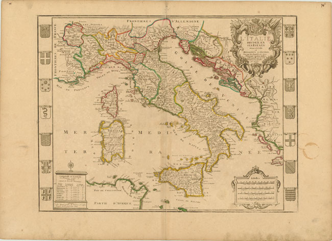
This rarely seen and highly decorative map is flanked on either side by panels depicting different regional coats of arms including those of Monaco and the Papacy. The map includes all of Italy, Sardinia, Corsica, Sicily, the Gulf of Venice and the western portion of the Balkans. It extends from Marseille in the west to show part of the Greek island Peloponnisos. The map locates scores of towns and villages, with each province and state delineated. The map is further embellished with a decorative title cartouche, a distance cartouche incorporating four distance scales, and a monument-style cartouche for the legend. This map was published by Nicholas De Fer’s son-in-law, Guillaume Danet.
Original color on watermarked paper with wide margins and light soiling. There are scattered faint spots, light toning along centerfold, and a stain in right-hand margin that just enters map border. Overall grade: B+ (or Very Good) condition. Size: 23.5 inches x 18 inches (59.7 cm x 45.8 cm). Ex-Old World Auctions, Auction #139. U.S. shipping only; international customers please contact me for shipping rates.
375.00
B+
1